
Unlearning Boundaries: AI, Regionalization, and the Future of Urban Design
Workshop Dates: 10/21
Location: Downtown, Detroit at Urban Tech Xchange Address: 1520 Woodward Ave, Detroit, MI 48226
Workshop Team
Dr. Karla Saldaña Ochoa, University of Florida, instagram
Dr. Shangde Gao, University of Florida
Mobina Noorani, University of Florida
Registration: Regular - $175, Student - $90
Registration
Workshop Description
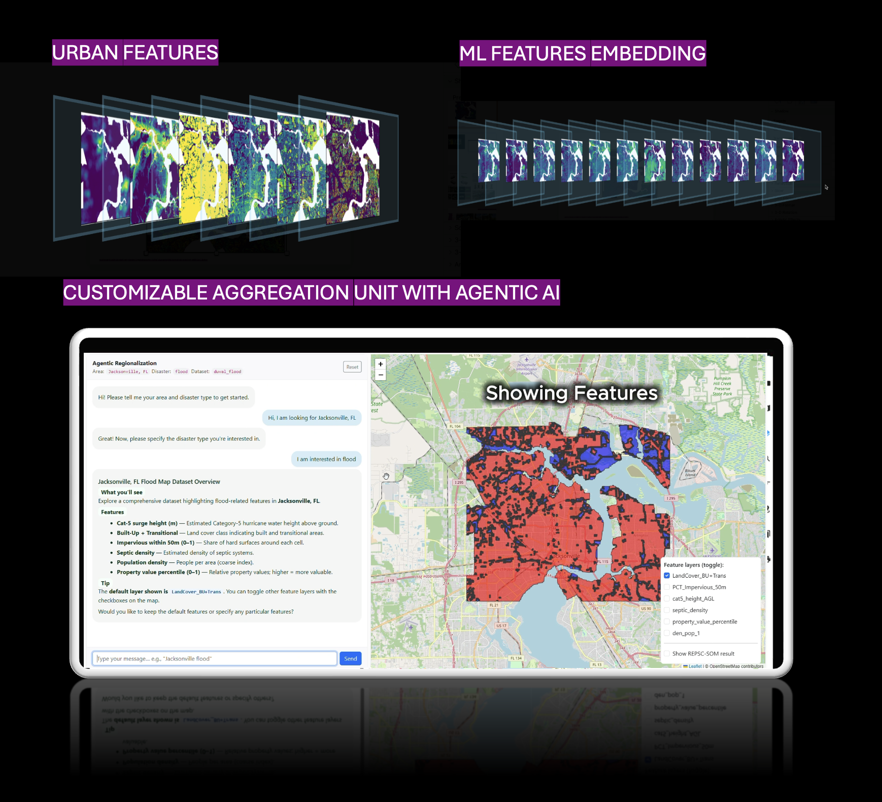
Cities are increasingly facing climate risks, demographic shifts, and uneven infrastructure development. However, the spatial units we typically use to analyze and design the built environment, such as census tracts, traffic analysis zones, and neighborhood boundaries, have remained largely unchanged. These regions are often established for specific needs, such as efficient postal service (ZIP codes) rather than design, yet they are often used to guide decisions and policies in urban design practices intended to represent the entire area where the design is planned. As demonstrated by various city interventions, these static boundaries often fail to reflect the diverse conditions architects and planners encounter when designing solutions. This in-person workshop aims to introduce a data-driven, demand-oriented approach to regionalization as a participatory alternative. The goal is to identify similarities among geographic areas based on specific needs, such as climate mitigation strategies, landscape architecture requirements, or urban infrastructure redevelopment. This workflow enables researchers and practitioners to create spatial units tailored to their design questions, sites, and concerns.
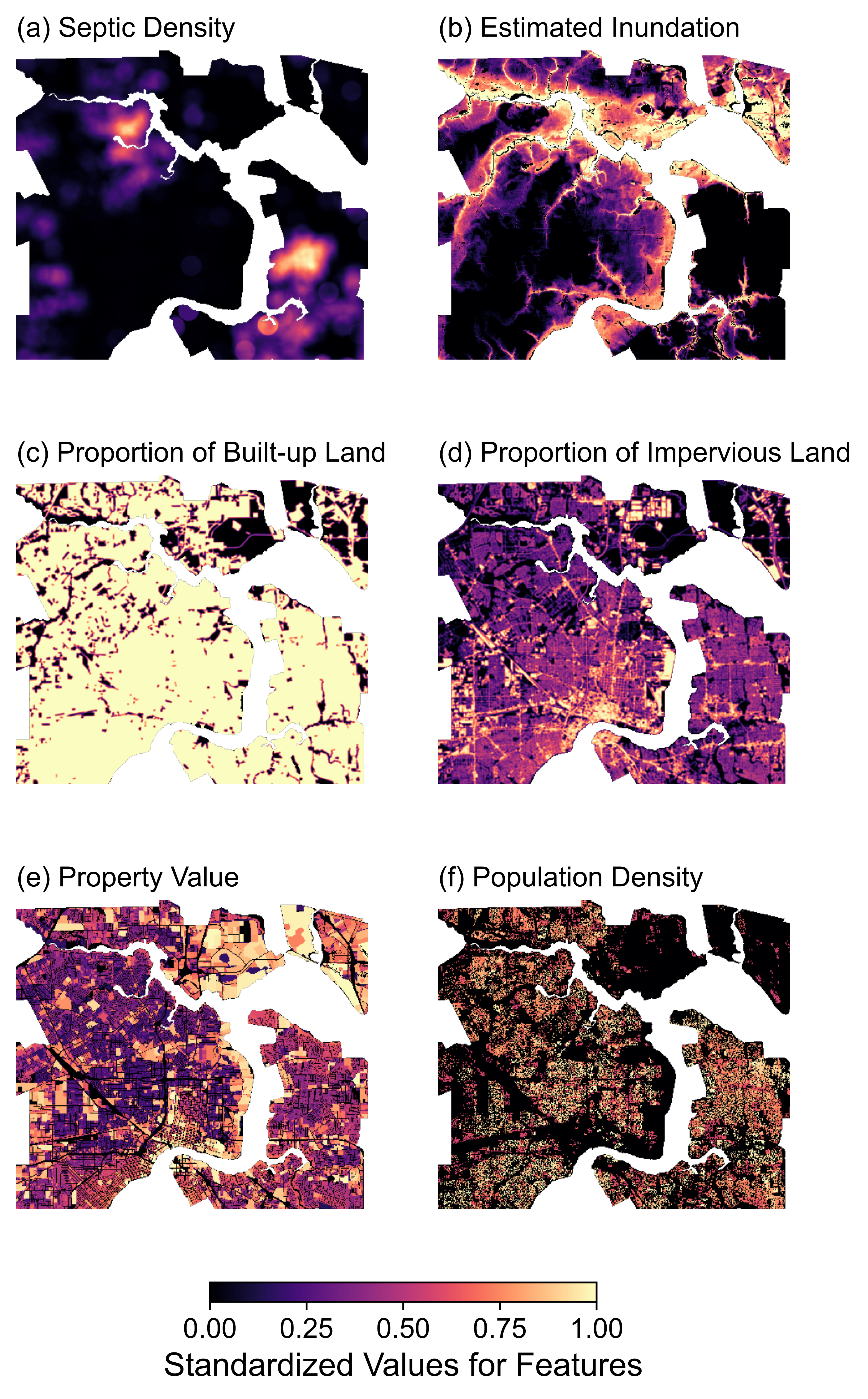
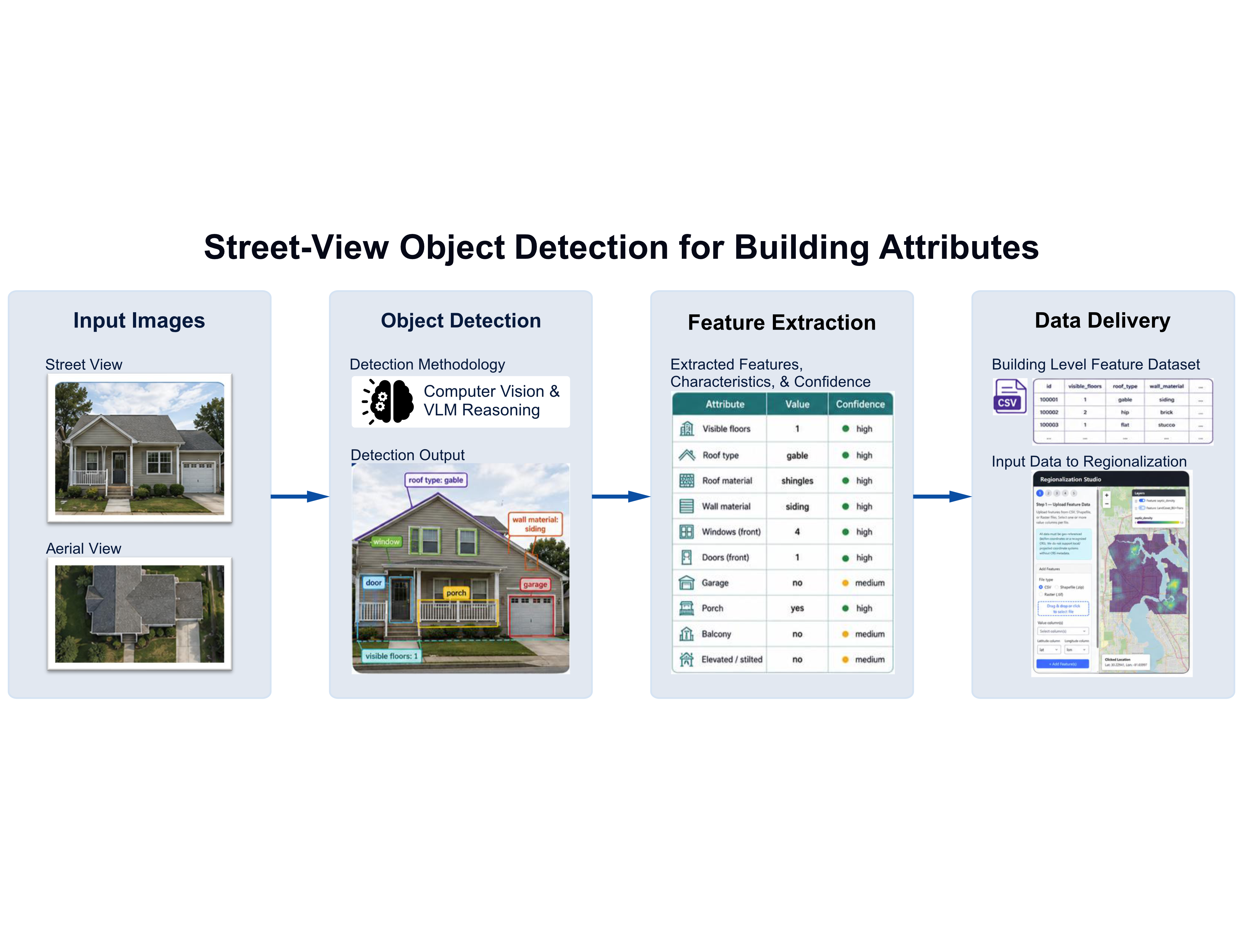
This workshop will explore how to create locally informed regions that encompass collections of similar geographical areas while distinguishing when a new group of similar areas begins. We will achieve this by integrating computational techniques with geo-tagged data from various sources. Our focus will be on AI geoprocessing methods, such as machine learning object detection, to analyze urban morphology using data from Google Street View, OpenStreetMap, and satellite imagery. Additionally, we will provide a list of open-source datasets that capture specific phenomena, including weather-related events like flooding. Participants will also have the opportunity to incorporate their own proprietary data, including urban and architectural models generated in any CAD software, to test how a particular design decision may influence a similar area and when modifications to the design solution may be necessary to meet the needs of a distinctly different area.
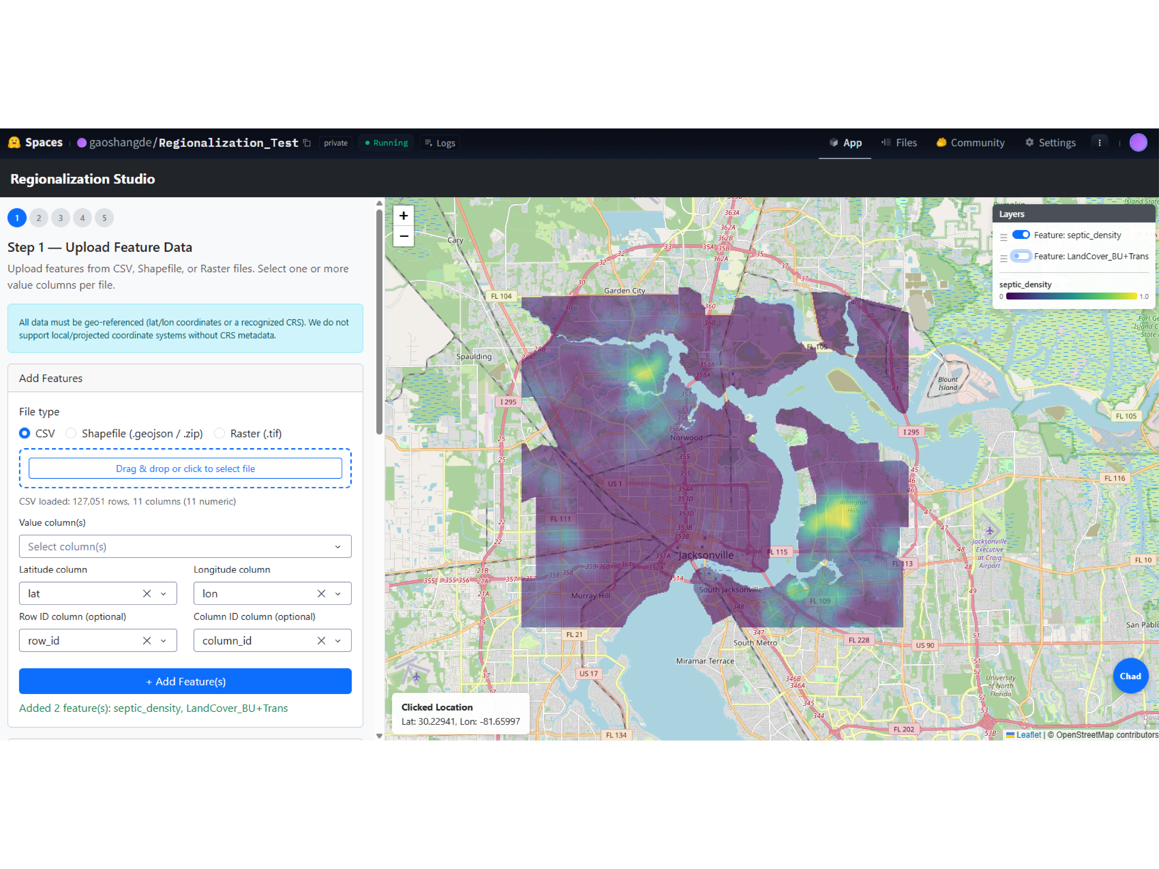
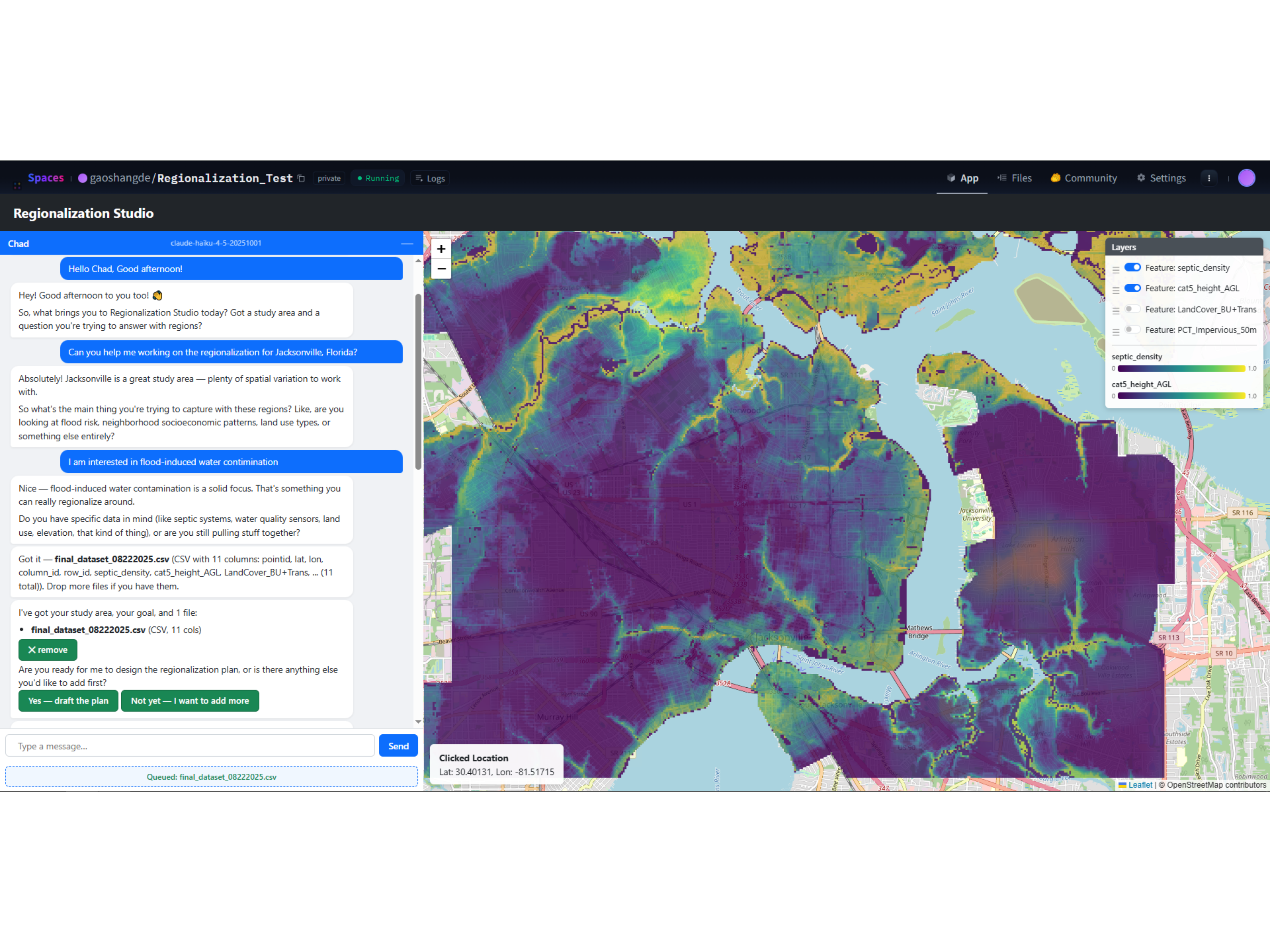
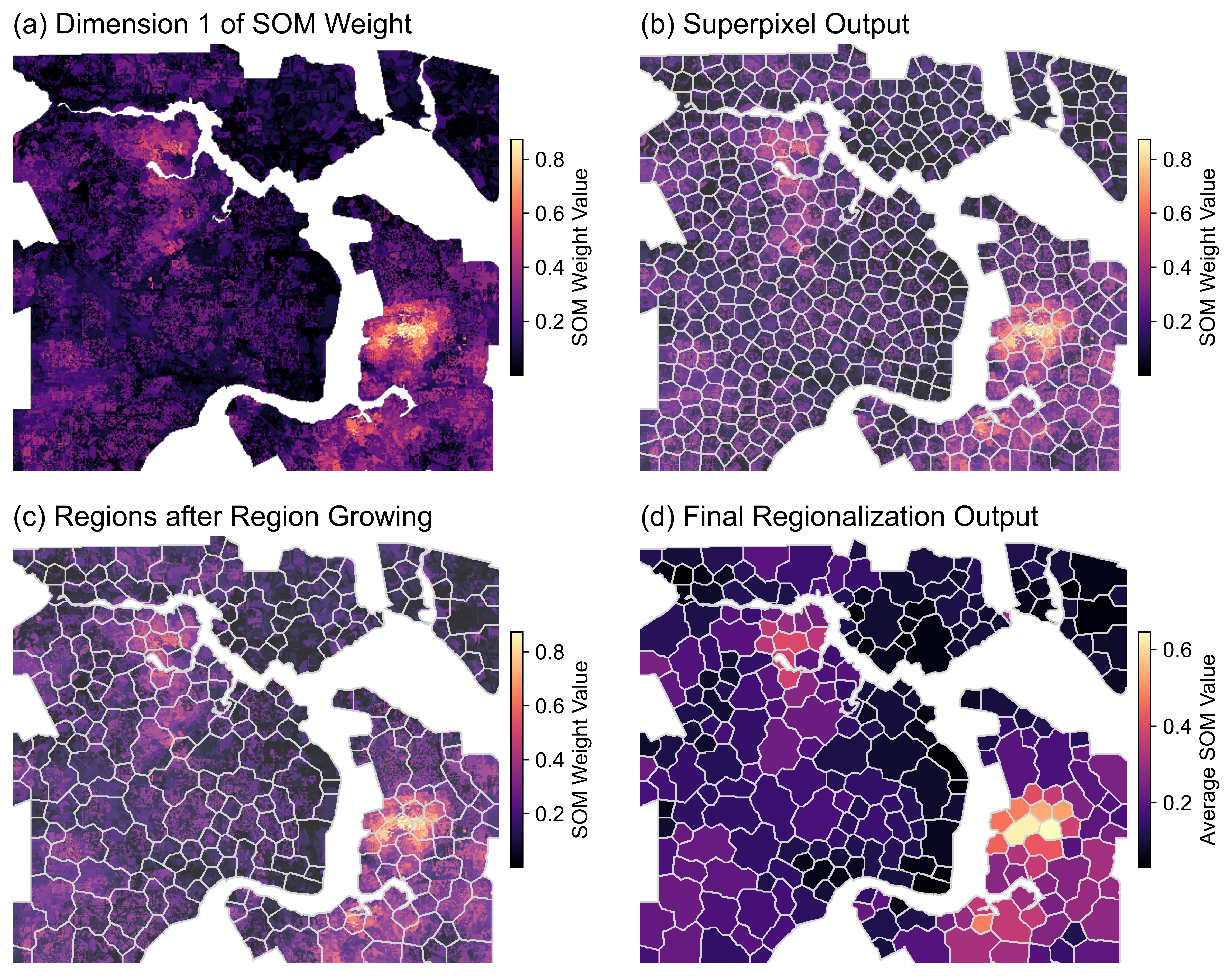
At the core of the workshop is RepSC-SOM (Representative-initialized, Spatially Constrained Self-Organizing Map), a regionalization method recently published in Nature’s Scientific Reports. In this human-controlled multi-step framework, participants can embed multidimensional features using an encoder, cluster grid maps under spatial constraints, and refine region boundaries using region-growing algorithms. Through a browser-accessed platform hosted on HuggingFace and supported by the Claude API, participants can configure the regionalization process and validate the generated regions against topic-specific data of their own choice, such as environmental, demographic, mobility, or material indicators.
No prior expertise in machine learning or geospatial analysis is required. Participants will be guided through the conceptual foundations and computational steps, with all platform tools accessible through the browser. Using a pre-configured pipeline and sample datasets from Detroit, MI, and Jacksonville, FL, attendees will learn to acquire and preprocess local data, extract and embed features from 3D building models for analytical use, generate demand-oriented regions, and critically compare their outputs against conventional administrative boundaries. Detroit’s own history of contested geographies (redlining legacies, shifting census tracts, and uneven environmental burdens) offers a particularly rich context for testing the relevance of locally generated spatial units.
This is a methodologically grounded, humanist-oriented workshop that bridges urban data science and architectural research in the context of situated, participatory design. At the end of the session, attendees will gain hands-on experience in data acquisition, AI-assisted data-driven regionalization, and statistically rigorous validation. The workflow will also contribute one case study to a co-authored compendium published in the ACADIA 2026 proceedings. This workshop is ideal for architects, urban researchers, educators, and graduate students who want to interrogate inherited spatial frameworks and develop their own data-driven units of analysis for climate-, equity-, and material-oriented research.
Learning Objectives At the end of the workshop, participants will be able to:
- Critically interrogate the assumptions embedded in standard spatial units used in urban design and planning research.
- Extract urban morphological features from Google Street View, OpenStreetMap, and satellite imagery using object-detection models hosted on HuggingFace.
- Extract and embed features from 3D architectural models for spatial analysis.
- Configure and run the regionalization workflow (RepSC-SOM), including geo-threshold tuning, feature embedding, and region-growing refinement, and validate outputs against topic-specific data.
Intended Outcomes Each participant will leave with: (1) a customized set of demand-oriented regions for a self-selected study area and research question; (2) a reproducible Python-based workflow integrating data acquisition, feature extraction, RepSC-SOM regionalization, and validation; (3) a comparative analysis of their regions against conventional administrative units. Collectively, the workshop’s outputs will be documented as a multi-site case library that demonstrates how data-driven regionalization can be situated within diverse architectural research agendas and will contribute to the post-conference proceedings.
Technical Constraints Participants need: a laptop capable of running Python 3.13 and Rhino 7 or higher; basic familiarity with coding; and HuggingFace Space and a Claude API key (provided via the workshop budget). Preparatory materials (such as a configured online environment, the RepSC-SOM codebase, and sample datasets) will be distributed two weeks before the workshop. No requirement for prior experience with coding or geospatial analysis.
Workshop Schedule
Day 1 Morning – Foundations and Setup
Time: 9:00 am – 1:00 pm Day 1: Foundations and Setup (3 hours, in-person)
09:00 - 09:30: Welcome & Framing: Workshop goals, instructor introductions, overview of demand-oriented regionalization and the limits of inherited spatial units.
09:30 - 10:15: Methodology & RepSC-SOM: Conceptual walkthrough of the three-stage framework, including data preparation, embedding-clustering-refining, and output validation.
10:15 - 11:00: Platform Introduction: Tour of the workshop platform, including object-detection pipelines on Google Street View, OpenStreetMap, satellite imagery, and feature extraction from 3D models.
11:00 - 11:15: Break
11:15 - 12:00: Live Demonstration of Detroit and Jacksonville Case: Instructors trace the full pipeline on the case samples, from data acquisition to regionalization output and validation.
12:00 - 13:00: Onboarding & Data Preparation: Platform configuration on personal laptops, HuggingFace and Claude API access, and participants begin preparing their 3D models, study areas, and validation datasets with one-on-one instructor support.
Day 1 Afternoon – Hands-On Regionalization and Critical Discussion
Time: 2:00 pm – 5:00 pm
02:00 - 02:30: Recap and Q&A: Review of regionalization setup; Q&A on issues while practicing with example cases.
02:30 - 3:00: Hands-On Regionalization: Participants generate demand-oriented regions for their own sites and research topics with one-on-one guidance on parameter tuning, feature selection, and validation strategy.
3:00 - 3:15: Break
3:15 - 3:45: Comparative Analysis: Each participant compares their generated regions against conventional units (census tracts, neighborhoods, or local equivalents).
3:45 - 4:45: Showcase & Critical Discussion: Short participant presentations, and open discussion on the interpretive, ethical, and design implications of participant-defined spatial units.
4:45 - 5:00: Closing & Proceedings Pathway: Forward look on extending the platform and coordination of contributions to the co-authored ACADIA 2026 proceedings compendium.
Total Workshop Time: ~7 hours
Participant Information
- Audience: Students, researchers, and professionals in architecture, design, and AI
- Skill Level: Intermediate. Prior knowledge of Rhino/Grasshopper is helpful but not required
- Group Size: ~20 participants
- Hardware: laptop capable of running Rhino 7 or Rhino 8 with Grasshopper
Workshop Gallery
Refund and Change Policy
Important: Refund and change requests will not be accepted beyond Monday, October 5th.